


Modern surveillance drones integrate sophisticated sensor arrays, thermal imaging, and AI-powered target recognition systems to provide unprecedented aerial monitoring capabilities. These systems enable law enforcement agencies to conduct crime prevention operations, support military reconnaissance missions, and facilitate environmental monitoring initiatives. However, deployment raises significant privacy concerns and regulatory compliance challenges across federal, state, and local jurisdictions. Professional stakeholders must navigate complex legal frameworks governing data retention, encryption standards, and Fourth Amendment protections while implementing effective surveillance programs.
Key Takeaways
- Modern surveillance drones integrate thermal imaging, multispectral cameras, and LIDAR to capture details invisible to human eyes.
- AI-powered recognition algorithms automatically identify and track targets in real-time across vast surveillance areas.
- Drones provide tactical advantages in military reconnaissance by detecting enemy movements and weapon deployments from safe distances.
- Environmental monitoring drones track nocturnal wildlife and assess vegetation health using specialized sensors unavailable to ground observers.
- Emergency response teams deploy drones to locate survivors under debris and map flooded areas inaccessible to traditional rescue methods.
The Technology Behind Modern Surveillance Drones
Modern surveillance drones integrate sophisticated sensor arrays, high-resolution imaging systems, and encrypted data transmission capabilities that facilitate real-time intelligence gathering across diverse operational environments. Contemporary drone technology leverages thermal imaging, multispectral cameras, and LIDAR systems to penetrate environmental barriers that traditionally limited surveillance effectiveness. These surveillance advancements incorporate AI-powered target recognition algorithms that automatically identify and track subjects while maintaining operational security protocols.
Additionally, enhanced situational awareness facilitates informed decision-making, further enhancing the effectiveness of these systems against potential threats.
Regulatory frameworks now mandate specific encryption standards and data handling procedures to mitigate privacy risks and uphold compliance with aviation authorities. Flight control systems utilize GPS-denied navigation capabilities, enabling operations in contested electromagnetic environments. Battery technology improvements extend operational duration while miniaturized components reduce detection signatures. Together, these technological developments create thorough surveillance platforms that balance operational effectiveness with regulatory compliance requirements.
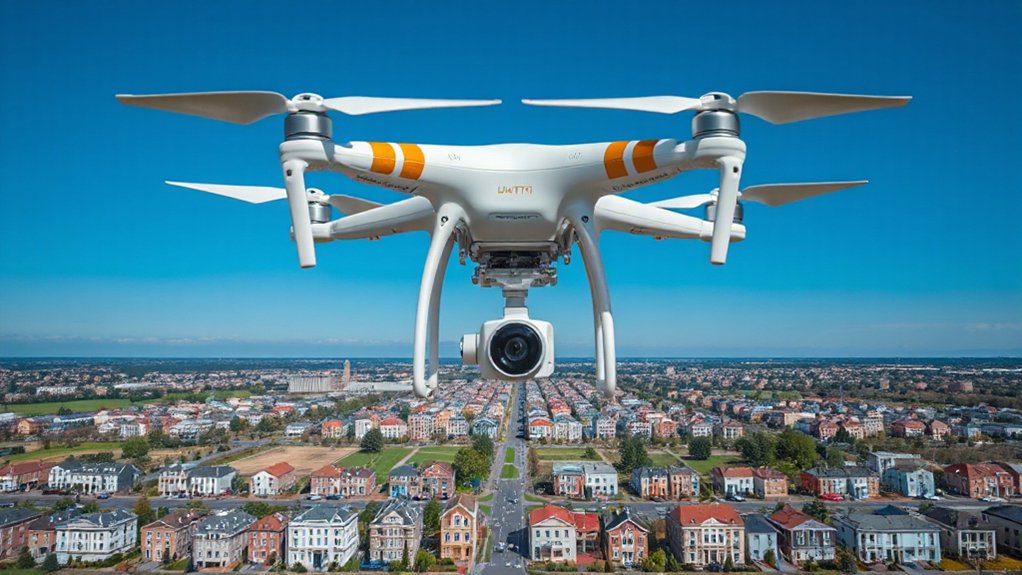
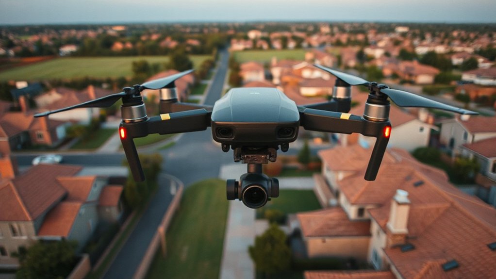
Law Enforcement Applications and Crime Prevention
Law enforcement agencies deploy surveillance drones to enhance operational capabilities across crime prevention, evidence collection, and public safety initiatives while steering through complex legal constraints regarding airspace usage and constitutional privacy protections. These unmanned systems enable rapid response deployment during active incidents, crowd monitoring at public events, and systematic patrol coverage of high-crime areas. Modern drone platforms facilitate real-time data collection through thermal imaging, high-resolution cameras, and GPS tracking capabilities that support investigative processes. Successful implementation requires strategic community engagement protocols that address citizen concerns about surveillance overreach while demonstrating tangible public safety benefits. Departments must balance operational effectiveness with transparency requirements, establishing clear policies governing data retention, access protocols, and civil liberties safeguards to maintain public trust and regulatory compliance. Additionally, employing corporate investigations can help organizations identify vulnerabilities, thereby enhancing the effectiveness of drone surveillance strategies.
Military and National Security Operations
Military drone surveillance enables precise tactical advantages through:
- Perimeter reconnaissance – Silent monitoring of hostile territories without compromising troop positions
- Real-time threat assessment – Immediate identification of enemy movements and weapon deployments
- Target verification protocols – Enhanced accuracy in distinguishing combatants from civilians
- Communication relay networks – Secure data transmission across distributed command structures
These systems support covert operations by providing commanders with extensive battlefield intelligence while maintaining regulatory compliance with international warfare conventions. Military strategists recognize drone surveillance as essential infrastructure for maintaining strategic advantage in contemporary conflicts, fundamentally reshaping how forces approach intelligence gathering and operational planning. Additionally, private investigator agencies, like Stillinger Investigations, can leverage drone technology to enhance evidence collection in various civilian investigations.
Wildlife Conservation and Environmental Monitoring
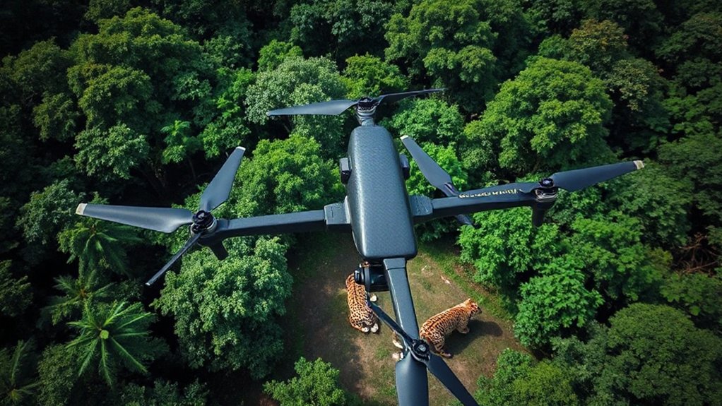
While military applications demonstrate drone surveillance capabilities in hostile environments, conservation researchers deploy these same technologies to monitor endangered species and track environmental changes across remote ecosystems. Thermal imaging sensors enable precise species tracking of nocturnal wildlife populations, while multispectral cameras assess vegetation health and deforestation patterns. Habitat monitoring protocols require strict adherence to aviation regulations, particularly in protected wilderness areas where flight restrictions safeguard breeding grounds. In this context, ethical practices involving legal compliance are vital to ensure that conservation efforts do not infringe on wildlife privacy or disrupt their natural behaviors.
Risk mitigation strategies address wildlife disturbance concerns through altitude maintenance and seasonal flight restrictions. Conservation teams integrate real-time data transmission capabilities to detect poaching activities and illegal logging operations. Regulatory frameworks mandate operator certification and flight plan coordination with wildlife management agencies. These collaborative surveillance networks strengthen conservation efforts by providing evidence-based data for policy development and enforcement strategies.
Emergency Response and Disaster Management
Natural disasters and emergency situations demand rapid deployment of surveillance assets capable of operating in hazardous conditions where traditional response methods face significant limitations. Drone platforms enable extensive disaster assessment while maintaining operator safety distances from contaminated zones, unstable structures, and extreme weather conditions.
Emergency responders rely on real-time aerial intelligence for critical decision-making:
- Thermal imaging reveals survivors trapped beneath debris in earthquake zones
- Flood mapping identifies safe evacuation routes through submerged neighborhoods
- Chemical plume tracking protects ground teams from hazardous material exposure
- Infrastructure damage surveys prioritize repair sequences for utilities restoration
Advanced sensor integration supports emergency logistics coordination by providing incident commanders with continuous situational awareness. Multi-spectral cameras penetrate smoke and dust, while GPS positioning enables precise resource allocation. Regulatory frameworks increasingly recognize drone operations as essential emergency services, streamlining deployment protocols during declared disasters. Additionally, understanding the importance of consent requirements in drone operations ensures compliance with legal standards while maximizing their effectiveness in emergency scenarios.
Privacy Concerns and Civil Liberty Implications
Expanding surveillance capabilities through drone deployment raises fundamental questions about the balance between public safety benefits and constitutional protections against unreasonable search and seizure. Organizations implementing aerial monitoring systems must navigate complex surveillance ethics frameworks that vary considerably across jurisdictions. Current privacy legislation often lags behind technological capabilities, creating regulatory gaps that leave communities vulnerable to overreach.
Legal experts emphasize that drone operators must establish clear protocols governing data collection, retention, and sharing practices. Without robust oversight mechanisms, routine surveillance activities risk eroding Fourth Amendment protections and community trust. Professional stakeholders recognize that sustainable drone programs require transparent policies addressing citizen concerns, judicial warrant requirements, and data minimization standards. Effective implementation demands ongoing dialogue between law enforcement agencies, privacy advocates, and the communities they serve.
Legal Framework and Regulatory Challenges
Traversing the complex web of federal, state, and local regulations governing drone surveillance operations presents significant compliance challenges for public agencies and private entities alike. Regulatory compliance demands careful navigation of existing privacy legislation while addressing liability issues that emerge from evolving legal precedents. Organizations must secure appropriate drone permits while ensuring robust data protection protocols meet international regulations standards.
Key regulatory challenges include:
- Jurisdictional conflicts between federal aviation authority and local privacy ordinances
- Evidence admissibility standards varying across different court systems
- Cross-border operations requiring multiple regulatory approvals and permits
- Liability frameworks for unauthorized data collection incidents
Ethical considerations increasingly influence policy development as lawmakers struggle to balance public safety benefits against constitutional protections. The regulatory landscape continues evolving rapidly, requiring stakeholders to maintain adaptive compliance strategies.
Future Developments and Emerging Capabilities
While regulatory frameworks struggle to keep pace with current drone capabilities, technological advancement continues accelerating at unprecedented rates, introducing sophisticated surveillance systems that will fundamentally reshape operational parameters within the next decade. Autonomous navigation systems utilizing artificial intelligence will enable swarm coordination, allowing multiple drones to execute synchronized surveillance missions across vast territories without human intervention. Advanced sensors incorporating hyperspectral imaging, thermal detection, and biometric recognition will penetrate previously impenetrable environments, identifying targets through dense foliage or adverse weather conditions. Edge computing integration will process data instantaneously, eliminating transmission delays that currently compromise operational effectiveness. These emerging capabilities present unprecedented opportunities for security professionals while simultaneously creating complex privacy and regulatory challenges that existing legal frameworks remain inadequately equipped to address thoroughly. Regular security assessments focusing on privacy protection will be essential to mitigate the risks associated with these advancements.
Frequently Asked Questions
How Much Does a Professional Surveillance Drone Typically Cost?
Professional surveillance operators encounter drone prices ranging from $3,000 to $50,000 depending on mission requirements. Budget options around $3,000-8,000 provide basic surveillance capabilities but may compromise range and image quality. Mid-tier systems ($15,000-25,000) offer enhanced sensors and regulatory compliance features. High-end platforms exceed $30,000, delivering thermal imaging, advanced stabilization, and extended flight times. Operators must balance cost constraints against operational needs while ensuring regulatory adherence.
What Training Is Required to Operate Surveillance Drones Legally?
Professional surveillance operators must obtain FAA Part 107 drone certification through thorough examination covering airspace regulations, weather patterns, and flight operations. Remote piloting certification requires demonstrated knowledge of federal aviation rules, emergency procedures, and privacy compliance standards. Additional state-specific licensing may apply depending on surveillance jurisdiction. Operators within the professional community recognize that proper certification guarantees legal compliance while maintaining industry credibility and operational safety standards.
How Long Can Surveillance Drones Stay Airborne on a Single Charge?
Commercial surveillance drones typically achieve flight duration between 20-45 minutes per charge, though battery life varies considerably across platforms. Professional-grade units may extend operational time to 90 minutes, while specialized long-endurance models reach several hours. Operators must factor environmental conditions, payload weight, and regulatory flight time restrictions into mission planning. Cold temperatures and high-altitude operations substantially reduce battery performance, requiring careful power management protocols.
Can Civilians Legally Shoot Down Drones Flying Over Their Property?
Shooting down drones constitutes federal destruction of aircraft under FAA regulations, regardless of property boundaries. While drone rights intersect complex property laws, civilian self-help remedies carry serious legal consequences including potential felony charges. Property owners share legitimate privacy concerns, yet federal airspace jurisdiction supersedes local property rights. Legal remedies exist through proper channels—law enforcement, FAA complaints, and civil litigation—rather than direct physical intervention against unmanned aircraft systems.
Which Companies Are the Leading Manufacturers of Surveillance Drone Equipment?
Leading surveillance drone manufacturers include DJI, Parrot, Autel Robotics, and Skydio in the commercial sector, while defense contractors like General Atomics, Northrop Grumman, and Lockheed Martin dominate military applications. Market trends show increasing regulatory scrutiny around data security and export controls, particularly affecting Chinese manufacturers. Drone technology advances focus on AI-powered autonomous flight, enhanced sensor integration, and compliance with evolving privacy regulations across jurisdictions.
Conclusion
Drone surveillance capabilities continue advancing rapidly, necessitating robust regulatory frameworks to balance operational benefits against privacy risks. Technical specifications must align with legal compliance requirements while addressing cybersecurity vulnerabilities and data protection protocols. Risk mitigation strategies require continuous assessment of emerging technologies, evolving threat landscapes, and constitutional limitations. Regulatory bodies must establish thorough oversight mechanisms governing deployment parameters, data retention policies, and cross-jurisdictional operational standards to guarantee responsible implementation across military, civilian, and commercial applications.

